Frost Fall

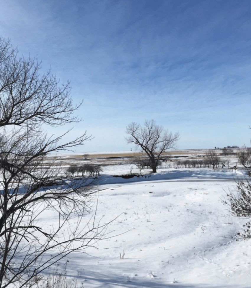
The New Year started out with several days that were a monochromatic fantasy world of white. Mysterious white-gray fog encased every exposed surface with pure white frost crystals. When the frost fell, the dirty snow and the brown grass got a thin coat of whitewash. And, the falling frost provided a lesson from the Land.

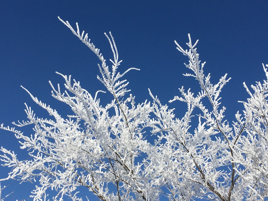
The tops of tall trees seemed to have a more complete covering of frost than the squat wild plum thickets. Don’t worry, I didn’t/couldn’t climb up the big tree to get the artsy shot of white frost against the blue sky. The photo on the right is an enlarged version of one that I took with both feet on solid ground.

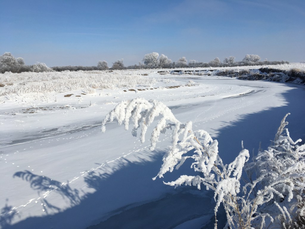
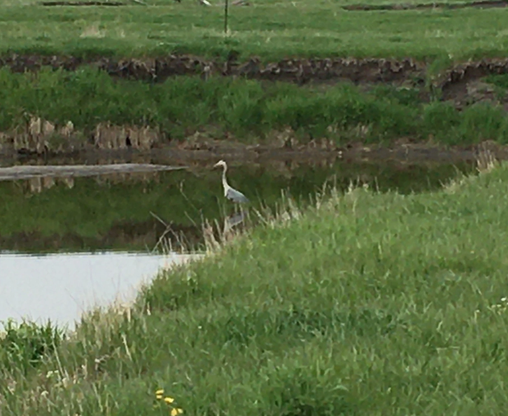
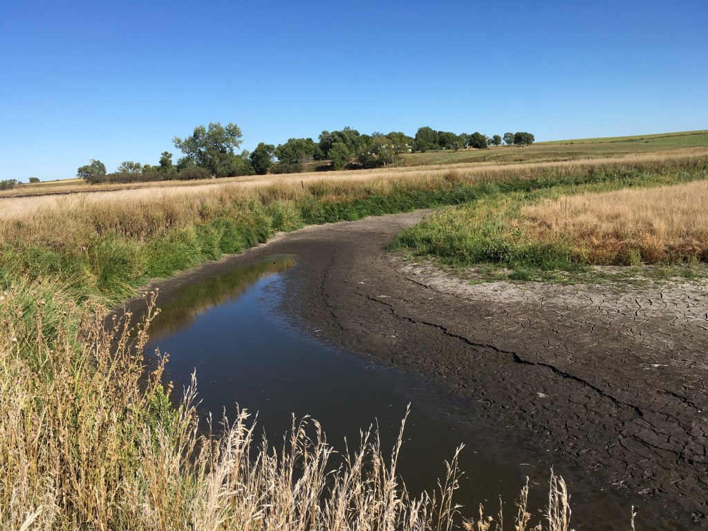
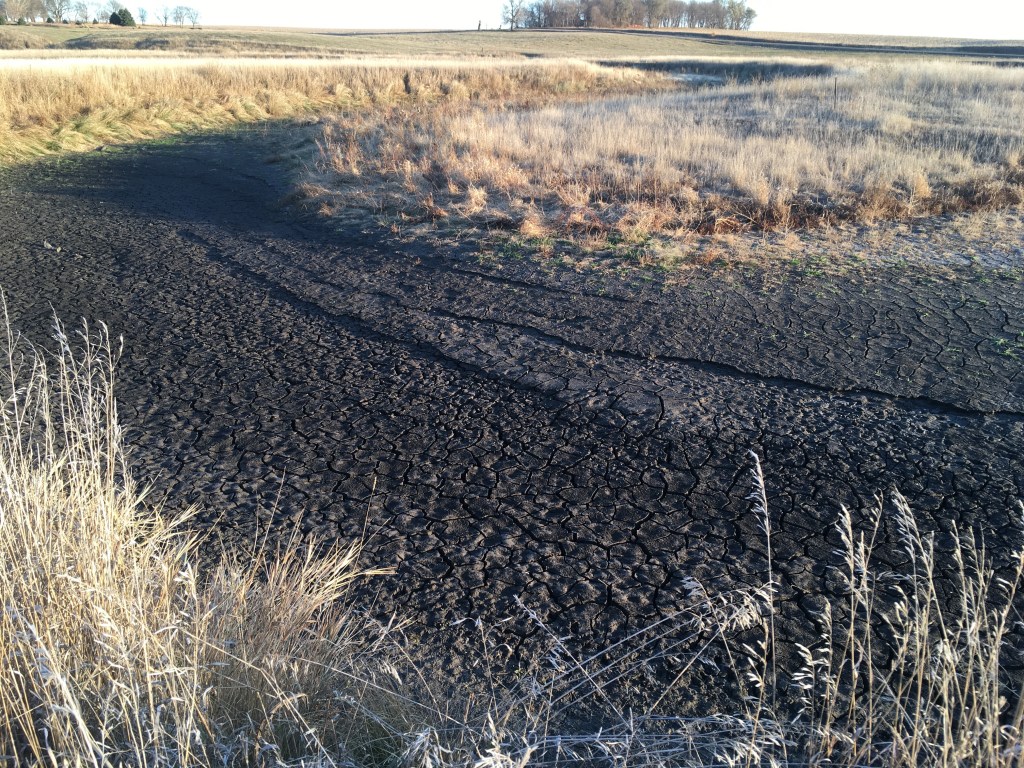
It wasn’t only the trees and plum thickets that got painted white. Every plant that stuck up into the moist air got frosted. These two are along the high bank of the main Creek channel. It’s easy to see why everything was muffled; the insulating frost soaked up all the sound that might be bouncing around. 

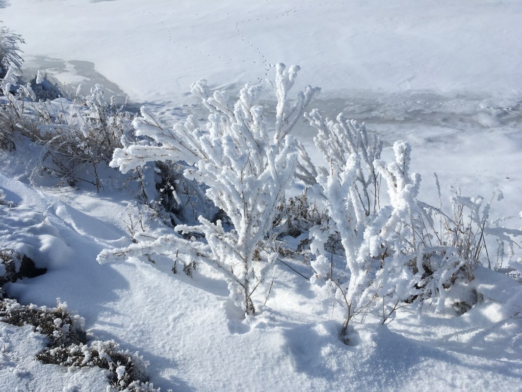
Fluffy seed heads had more intricate exposed surfaces and so the frost cover was more complete than on the narrow leaves and smooth grass stems. The growth of the frost crystals is due to a phase change of water vapor (which is a gas) to the solid ice crystals. We usually think of ice freezing from water, but the frost formation skips the intermediate step of liquid water and there’s a direction conversion of a gas into a solid.

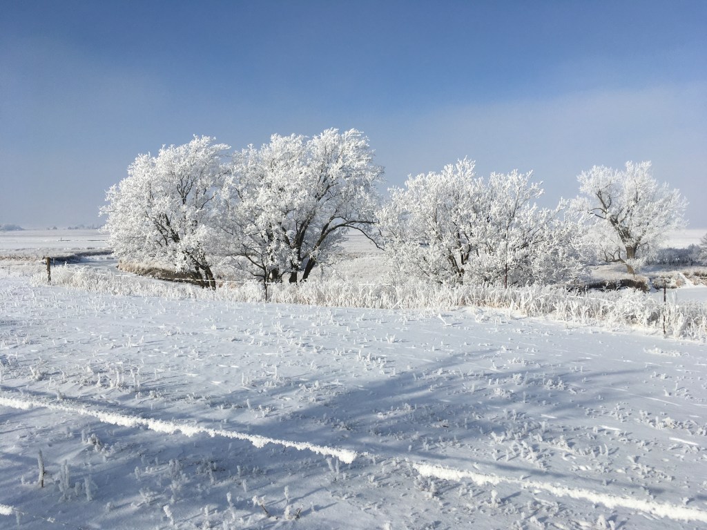
But, not all exposed surfaces were plant material. Metallic wires didn’t get a coating as thick or as complete as the vegetation. Also when the frost started falling, the wires dropped their white frost first. That’s what produced the line on the ground in the photo on the right.

Although Nature sent a warming breeze that started to dust off everything, even the tall trees, I also shook the frosting from several wires and plants. But, then I suddenly realized what I was doing: I couldn’t resist the urge to exert human control. I should just have trusted and respected Nature’s way of doing things. It was an epiphany for me.

Today is an appropriate day to share this sudden revelation. It is Epiphany which is a day celebrated as a part of the “Twelve days of Christmas” in several Christian traditions. This is supposed to be when the Wise Men brought their gifts. In it’s wisdom, the Land sent a lesson about humility in the white frost. That’s a great way to start the New Year!

If you would like an email notice when these blogs are posted, there is a way to do that: when you’re scrolling through a post, there’s a bar that pops up in the lower right corner, but only if you move up with the scroll. That bar has three dots and if you click the dots, you’ll get the chance to click a “follow” icon.

I know “it ain’t easy”, so I’ll continue to share the link through Face Book. However, it’s not clear when or who gets to see the Face Book notices. But, if you can follow the Word Press procedure, you’ll get an email when I post these “literary gems” on Wednesday afternoons. Thanks.

Posted in Earth Science | Tagged , , , | Leave a comment

Double Eagle Days

Earlier this month we had a string of eight or nine days that were mostly clear, sunny, and warm. And, almost every day we saw a mature bald eagle “parked” in the big cottonwood that we can see from our porch. On a couple of those days we saw two mature eagles! Another large brown bird was also periodically in the area and we think that it may have been an immature bald eagle.

The double eagle picture on the left is one that Margaret took back in early November. That’s when we first became conscious of visits from a pair (male and female?). Unfortunately, we didn’t get any pictures of the “double eagle days” in the December stretch of warm weather. But, the photo on the right was taken on one of those December days when we did have a single, vigilant visitor.

Our eagle tree is located in the light green circle added to this screen shot from a Goggle satellite image. A couple of miles up Kanaranzi Creek we’ve seen an eagle perched in a large tree that’s part of the “Jungle” of trees and plum thickets up on “Rainbow Curve”. That sighting location is shown by the orange circle in the upper right part of the image. About four or five miles downstream, near where the Creek joins the Rock River, there are reports of eagle nests and we’ve seen them flying in that area marked by the larger orange circle in the lower left corner.

That string of warm days in early December got me all enthused about seeing eagles. But, there was nothing for two weeks! The weather was warm, with lots of the days that were cloudy. Don’t the eagles come around in cloudy weather? Maybe it’s the sky conditions rather than the warm temperatures? Then, on the day before and the day of the Winter Solstice, we had clear and warm weather. I kept a pretty close watch both of those days, but they didn’t show up.

Three days later on the morning of Christmas Eve, we suddenly saw a mature bald eagle in the cottonwood tree! There was a clear sky, but the temperature was below zero. Maybe sky conditions are more important than temperature in determining when they fly around? The next afternoon, Christmas Day, the sky was clear, the temperature was in the 30s, and we had another eagle in the cottonwood tree!

What’s the message here? It’s not about trying to see a pattern in the sightings. It’s about the surprises that Nature has for us. I looked for an eagle on the Winter Solstice and none showed up. But, then on Christmas day there was one! We can try to make an appointment with Nature based on perceived patterns, but the eagles still decide when to put in an appearance. The lessons that the Land shares with us are like prayers: sometimes they don’t directly answer the questions that we ask and sometimes we’re surprised to learn something that we haven’t even thought to ask about. We just have to keep alert in order to tune into the insights that Nature sometimes provides us.

POSTSCRIPT…. But wait! There’s more! Most of this post was written yesterday with the intent of putting it out today. This morning at around 8:00, I was having my coffee and watching the sunrise, when I happened to glance out the window. There were two mature bald eagles in the cottonwood tree! This photo was taken on this last day of 2020! They stayed only about half an hour and didn’t show up the rest of the day (I kept watch pretty carefully!). I’m thinking that Nature had the eagles put a benediction on this crazy year! There’s new hope and new light in 2021!

HAPPY NEW YEAR!

Posted in Earth Science, Life Science | Tagged , , , | 3 Comments

SEASONS CHANGE

Seasonal rounds are an intrinsic part of life on the prairie. They’re an experience shared by Ice Age animals and plants, by Native American hunters and farmers, and by homesteaders and people in agribusiness. But, 2020 has been different. COVID-19 is a life form that has impacted rural and urban populations all over our country and all over the world. And the pandemic has evolved as distinct cycles tied to the changing seasons. In addition to the familiar and normal attributes of each season, COVID-19 has added some distinctive and devastating patterns.

Winter is regarded as a time of dormancy and preparation in many cultural traditions. Plants and animals are waiting for warmth under the white snow. It’s a time of rest (unless there are early calves to take care of) and incubation, getting ready for the growth spurts that are coming later. During this year’s gestation period, the total precipitation on the Farm is almost an inch under the normal average. The past two years have had record rainfall, so the subsoil moisture is in good shape. But, that seasonal moisture deficit is an omen for difficulties to come.

Although the first COVID-19 death in Minnesota doesn’t happen until the last part of March, the first one in the US is in early February. Most of the initial impacts are on the East and West Coasts and in urban areas. It’s relatively quiet in our area, but the virus is silently spreading all over the country and world. Like the moisture deficit, the winter infections have big impacts over the next several seasons.

Spring is a busy time of riotous new life and rampant growth. Eventually, the green shows up, but at first there are still some snow banks in protected areas. The main channel of the Creek does run bankfull in spite of the continuing reduced rainfall. That’s probably due to groundwater seeping out to support the flow of surface water because we’re again about an inch below average for the season.

The first of the US pandemic peaks hit in mid-April. Although the daily rates of infections and deaths are smaller than in the peaks-to-come, there is fear bordering on panic. And, it’s warranted because there’s one death for about every 15 infections. That’s a much higher threat than in the peaks-to-come.

Summer is the time when the green and growing things began to mature into gold and brown. It’s also a time when there’s less rain than in the spring. This year, however, there’s much less rain. The green of the early summer is tempered by the later brown drought signal. We’re three inches below normal, so that makes us five inches under for the year. But, the drought is going to deepen even further.

And, COVID-19 peaks again in the US at the end of July. Daily infection rates are higher than in the spring, but there’s only one death for every 55 infections. It seems like things are improving, although the total numbers continue to increase and the stage is set for the climb to another peak in the fall.

Fall is when the rewards of the harvest are collected. The leaves have left the trees, but these photos are misleading. Everything looks brown on the first of November and December, but both months had significant snowfalls that had totally melted away by the time that the pictures were taken. The shortage of rain didn’t seem to impact harvest yields significantly. The rains must have come at just the right times and we probably are also making withdrawals from the groundwater storage. We’re still another two inches below average at the mid-December mark. Officially, the drought index says we’re in a moderate to severe drought. The year is ending on a lot different note than last year.

COVID-19 is killing record numbers of Americans. We personally know some people in our area who have died and several of our neighbors have tested positive. The national post-Thanksgiving ramp-up in death count amounts to the equivalent of one Nine-Eleven event every day! On December 17, there are almost 240,00 new cases and about 3,300 deaths. However, that’s only about one death for every 72 infections. The total numbers are staggering, but apparently health care procedures have been refined so that threat of death is less than in the spring and summer surges. And of coarse, there’s hope on the horizon because vaccines have now become available.

The precipitation and pandemic patterns carry some important “lessons from the Land”. In the jargon of the current generation and cultural heritage, those lessons sound like: trust the science; monitor and adjust; keep calm and carry on; don’t be afraid. And, “Keep your stick on the ice. We’re all in this together.” That last bit of wisdom is from an old prophet who lives up in the North Woods, rather than on the tall grass prairie. His name is Red Green and loosely translated from the Canadian hockey language, this advice would probably sound something like: “Don’t beat each other up. The team/family/society needs to work together.”

This post comes two days after the Winter Solstice and two days before Christmas. Both of these celebrations call us to give up the dread of darkness and cold and live up to the promise of light and warmth. And to add to the Holiday cheer, here’s the link to the just-released Holiday episode of the Prairie Podcast (Season 3, Episode 11). It’s one of the resources that helped to inspire the last few blog posts on changing environments, cultures, generations, and seasons on Lone Tree Farm. Some of the online sources for the information (especially the numbers) in this current post include the Minnesota Climatological Network, the Minnesota Department of Health, and the graphics posted by the Reuters COVID-19 Tracker. Happy Holidays!

Posted in Earth Science, Family History, Farm History, Life Science | Tagged , , , | Leave a comment

GENERATIONS CHANGE

Four generations of our family’s Grandmothers have lived and worked on Lone Tree Farm since 1871. All four had the kind of quiet courage that holds young families together and contributes to viable farming operations. However, each woman had her own unique set of gifts. This third in a series of four “Advent” posts provides a thumbnail sketch that includes each Grandmother’s favorite tree as described in an earlier post.

Harriet Cackett Shurr (1846-1928) was born in Wales and immigrated with her mother to upstate New York. Her mother and stepfather tried unsuccessfully to homestead in Wisconsin’s Big Woods when Hattie was a child. However as a young mother with three children, she helped to homestead near the cottonwood tree that gives this farm its name. We have family letters describing their dramatic arrival. They thought that a cabin would be waiting for them, but it wasn’t there and her husband wanted to turn around and go back. However, Hattie persisted and they stayed.

One of Hattie’s gifts was art. This is one of the miniatures that she did in pastels, but she also worked with pen and ink and oil paint. Ironically, most of her landscapes are reminiscent of upstate New York. Her religious fervor was another gift that was a mixed blessing. Although she helped to establish several churches and Sunday Schools, there’s also family “gossip” about how her religious zeal influenced the decisions of five of her nine children to leave the area.

Daisy Edna Shurr (1881-1957) was born on a farm homesteaded by Irish immigrants that was located close to Kanaranzi Creek about five miles upstream from Lone Tree Farm. After teaching country school for several years, she came to the farm as a young bride. The lilacs that she planted when she first arrived are still alive and bloom every spring. Although Daisy was somewhat frail, she worked as hard as any farm wife was expected to do in those days.

Daisy’s gifts were an interest in history and storytelling. Her father was a veteran of the Civil War and when her young husband enlisted in the Spanish American war, they shared a rock with a hole in it from Kanaranzi Creek. In her Irish tradition a rock with a hole in it is good luck. Her great granddaughter now has that treasure. Daisy used to tell my brother and me stories about Native Americans along the Creek and commonly pointed to leprechauns that always disappeared before we saw them.

Bernita Bell Shurr (1918-2014) was born on the banks of Plum Creek near Walnut Grove, Minnesota. She got a four-year degree in mathematics and after teaching for several years she got certified in library science. Her granddaughter, who is a middle school librarian, now owns Bernita’s old textbooks. When her son was killed in Viet Nam, Bernita became a strong antiwar advocate, although that loss would have a profound affect on her life until the very end.

Bernita’s gifts were her independence and her love of Nature. One of her students from the early 1950s just recently told me what an important role model she was for young women. Bernita encouraged us to find adventure down in the pasture along the Creek, although she secretly supervised our activities without us knowing. Wild plum trees in full bloom represent her commitment to learning from Nature.

Margaret Ann Siemer Shurr (1944-present) was raised on a farm very near Kanaranzi Creek about eight miles upstream from Lone Tree Farm. All four of her grandparents were German and had farmed for several generations. When Margaret was ten years old, her mother died. Although she always credited her family’s help, it was mainly her own personal resiliency that got her through the trauma. And, it was her courage that took her away from the family farm to get her college degree and then teach in several different metropolitan areas.

Margaret’s gifts of empathy and compassion extended beyond teaching and raising a family. When we moved to Lone Tree Farm twenty years ago, she planted evergreen trees….a lot of evergreen trees. She also cheerfully pitched in to provide help and support for the three “oldsters” who we had primary responsibility for. And, she joyfully did the same thing for our four grandchildren. Margaret’s gifts also include those of the other grandmothers: she’s independent, interested in family history, loves Nature and is artistic. She’s got a following on Facebook for her “The View From The Porch” photos.

These blog posts on “changes” have basically become “teasers” for the DNR Holiday “Prairie Podcast” that’s still coming. I’m sure that there’ll be lots of other stories in that podcast if the previous years are any indication. These posts on changes are an expansion of segment that’s only about five minutes long. So there should be something for everyone. Watch for it.

Posted in Family History, Farm History | Tagged , , , | 1 Comment

CULTURES CHANGE

Here is the second in a series of four holiday posts celebrating changes on the tall grass prairie and learning from the land. This is a time of celebrations: Christmas, Hanukkah, Kwanzaa, and Solstice. These are the most familiar ones, but almost every culture has some kind of celebration marking the end of the year or the beginning of winter. Before the current Euro-American culture was transplanted to the prairie along Kanaranzi Creek, there were as many as five separate Native American cultures that lived in this creek valley.

As described in last week’s post, fossils of Ice Age animals have eroded out of the channel banks in the last few years. There may have been Paleoindians hunting in this area 10,000 years ago. But in addition to those very early cultures, there are bones and artifacts that are much younger. Some of the small pieces of bone seem to have cut marks from the butchering. These “fossils” are the remains of buffalo or bison that were hunted here in more recent times and the artifacts document what archaeologists call a “multicomponent site”. That means that a number of different cultures lived along the Creek far back into deep time.

Mauls or hammerheads have been found in the cultivated fields on the uplands around the valley. But, these artifacts aren’t distinctive enough to be diagnostic of specific cultures or particular times. On the other hand, some arrowheads or projectile points can be associated with specific cultures. At least one of the arrowheads found along the Creek channel in the floodplain, has been interpreted by an archaeologist to be from an Archaic cultural tradition. That represents a second Native American culture that was here about 2,500 years ago.

A third culture is documented with these two pieces of pottery and by a detailed geophysical study that mapped a possible dwelling outline and associated storage pits. Distinctive patterns in the pottery are diagnostic for a specific cultural tradition and the geophysics map suggests that the people of this Great Oasis culture lived here about 1,000 years ago. These interpretations are all based on more detailed data here on the farm than are available for the earlier cultures. The people of the Great Oasis culture are possibly early ancestors of the Mandan and Hidatsa tribes that historically have lived in North and South Dakota.

About 500 years ago there was a “Silent City” with thousands of inhabitants located approximately 30 miles west of the Farm along the Big Sioux River. This Oneota tradition built mounds at Blood Run in Iowa and is described in displays at Good Earth State Park across the river in South Dakota. This diagram of a storage pit for corn is in the Visitor’s Center at the park. The Oneota people raised corn and stored it in cache pits. These corncobs were collected this past summer on sand bars along Kanaranzi Creek and are probably prehistoric cobs because they have about half as many kernels in each row as modern corn. Like the Oneota, the people of the Great Oasis tradition raised corn and stored it in pits so these prehistoric corncobs might be from the earlier agricultural activities. But, the Oneota had extensive trade networks and quarried pipestone in southwestern Minnesota. Although the evidence is indirect and the idea is speculative, maybe this is a fourth Native American culture that traveled along the Creek? It is believed to be the precursor to the modern Omaha, Ponca, and Ioway tribes now living in Nebraska, Kansas, and Oklahoma.

Our grandchildren found these two artifacts along the Creek just behind our house. They’re probably related to the Great Oasis occupation because that’s the culture that we have the best record of. The blades seem pristine and may have been for ceremonial use rather than utilitarian knife blades. All of our understanding of the ceremonies celebrated by these ancient cultures is based on interpretations of physical artifacts. In contrast, there is a fifth Native American culture that has been directly observed to travel and live along Kanaranzi Creek. The Dakotah people encountered the homesteaders who settled here 150 years ago. We have family stories of kids playing together and adults interacting with mutual help and trade.

It’s commonly recognized that diversity is good. For example, a diversified portfolio reduces investment risk and biologic diversity is a hallmark of resilient natural systems. Cultural diversity is something that people look for by traveling all over the world. But, there’s a lesson from the land here that says cultures have always changed out here on the prairie. Back through time there’s been a continuity of humanness. No matter what their cultural tradition, all people want to care for their family, earn a living, maintain a safe environment, and practice their spiritual beliefs.

The idea for this series of holiday posts originally came from an invitation to contribute to a “Prairie Podcast” organized by the MN DNR for people working in the tall grass prairie. It hasn’t “dropped” yet, but I’ll let you know when it becomes available.

Posted in Farm History | Tagged , , , | 2 Comments

ENVIRONMNETAL CHANGES

This is the first in a series of four seasonal posts that speak to changes: environmental changes, cultural changes, generational changes, and seasonal changes. They’re all based on insights provided directly by life on the Farm and rooted in the tall grass prairie. We’ll call this series “Learning from the Land”.

There are two types of glacial sediments on Lone Tree Farm. Well-sorted sand and gravel was deposited by water from a melting glacier and poorly sorted clay with boulders deposited directly by the ice in an older glacier. This “outwash” sand and clay “till” have been described in several posts over this past year. The fractured till has served as an “aquifer” in the last several years when we had lots of rain. The flow conditions during high water levels in the Creek channel have eroded things from the buried outwash sands that provide clear lessons from the Land.

Ice Age fossils started showing up on modern sand bars! This tooth and bone are from a mammoth that lived in the general area about 10,000years ago. The fossils have been identified by a scientist who works at the Mammoth Site in Hot Springs, South Dakota. He’s seen a lot of mammoth remains and has lots of experience interpreting the environment that they lived in. The animals may not have lived directly in the glacial valley now occupied by the Kanaranzi Creek, but their remains probably washed down the meltwater stream to be deposited with the sand and gravel now located on the Farm.

That ancient stream came from the front of the melting glacier that was about 15 miles northeast of the Farm. This map is taken from a publication by the Minnesota Geological Survey and shows the valleys of the meltwater streams in yellow (4). The main ice mass of this last glacier in the area is marked by the light brown color (3) in the east and north half of the map. The end moraine that was the front of the glacier is the red-brown (3) strip that trends diagonally through the middle. And, the darker brown (4) western half of the map is deposits from an older glacier. Those are all geological interpretations based on the materials observed in the map area and on observations and interpretations from other areas. In addition to the mammoth fossils found on the Farm (A), there are collections from gravels to the northeast at Adrian, MN (B) and to the southwest at Rock Rapids, IA (C).

There is also a collection of mammoth remains from a location along the Big Sioux River near Brookings, SD, just to the northwest of the map area. That site also includes artifacts from the PaloIndians who were hunting these big beasts. Maybe there were also hunters working along Kanaranzi Creek back 10,000 years ago? There’s a theory that large Ice Age animals (called “megafauna”) like the mammoths, were hunted to extinction. But there’s still disagreement about this interpretation among the scientists who are doing these studies. There’s no disagreement about what mammoths look like, however. These two photos are reconstructions on display at the Mammoth Site in South Dakota.

And, there is pretty much complete agreement about the interpretations of the environmental changes that we know as the Ice Ages. The descriptions of earth materials and the age dates are universally accepted among the scientists who are trying to visualize the advance and retreat of the multiple glaciers. That doesn’t necessarily mean that everyone agrees about the causes of those environmental changes. One idea is that changes in the earth’s orbit helped produce the environmental shifts and there’s general consensus that carbon dioxide also played an important role.

This is all somewhat similar to the current debates around climate change and the COVID pandemic. There’s general agreement about the data (with some glaring exceptions), but there are dramatic differences in opinion about the interpreted causes. In fact, there’s a spooky similarity between the exponential growth curves for carbon dioxide levels in the atmosphere and the COVID case counts. And, these discussions are clearly mixed up/messed up with politics and opinions from people who are unfamiliar with the data. There are actually a couple of important lessons from the Land here: 1) adapt to new conditions or go extinct and 2) exponential growth is not sustainable in healthy natural systems.

The idea for this series of four holiday posts came from an invitation to contribute to a “Prairie Podcast” organized by the MN DNR for people working in the tall grass prairie. It’s not out yet, but I’ll let you know when it becomes available.

Posted in Earth Science, Life Science | Tagged , , , | 3 Comments

Fly Over Country

Our bird populations have seasonal rounds. Most of the songbirds like robins and meadowlarks have left. Now the main birds that we see are either passing through or are the ones that stay around all winter.

Bald eagles stay year round. Here’s a photo of one that was recently flying around the ‘Eagle Tree”. When we first moved back to the Farm twenty years ago, an eagle or a coyote sighting was rare and exciting. A friend who is a naturalist confirmed that. He says the first bald eagle that he saw in Rock County was in 2008. Now both critters are more common and we’re glad for it. Coyotes get blamed for killing calves and consequently there’s a hunting season for them. At one time people shot eagles to protect chickens. Now, the bald eagles are protected. Maybe someday we’ll recognize that both eagles and coyotes are only a minimal threat to domestic animals. Both species are mainly scavengers rather than hunters and they’re doing an important service that’s an integral part of a robust prairie ecosystem.

These pictures are from a blog post last spring. They’re taken in the pond and wetland complex that are located in the abandoned meander (the “oxbow”). The herons have left for the fall, but the geese are still around. In the spring they come up the Creek from the Rock River to build nests. In the fall they periodically come and go. These local homebodies fly low and are probably wintering nearby. In contrast, the high-flying, v-formations are long distance migrators headed south.

During the unseasonably warm weather several weeks ago, I heard a really distinctive birdcall. I think that it may have been sand hill cranes because they sounded like online examples that I found. I never did see them but I assume that they were flying high and fast. I don’t think that I’ve ever heard them here before. Isn’t the sand hill migration route usually farther west so they can hit the Nebraska Sand Hills for a rest stop?

Owls are one of the birds that are here all year, lingering through the winter. We usually hear them before sunrise and after sunset, but we don’t often see them during the daylight. After the snow last week I did see one up east of the homesteaders’ house (the “Greats’ House”). Maybe this hole is an owl house? We also have crows, starlings, flickers, blue jays, hawks, and sparrows that stay all winter.

Margret is a better photographer than I am. Here she is taking a picture of the pair of bald eagles that we saw this morning. You may have seen it on her Face Book post. She is recording the unique opportunity, but I first saw them when I stepped outside on the porch. I was following the lead of one of my nephews who once told me, “If you can’t pee off your porch, the neighbors are too close.”

Bald eagles are the symbol of the United States of America. They are also spiritual guides for Native Americans. And, they are icons for a healthy prairie. I’m grateful for the privilege of living on the prairie. 

I hope that you will all enjoy a safe holiday this week celebrating the joys of family, food, and gratitude.

Posted in Life Science | Tagged , , , | 2 Comments

Nature Will Not Be Denied

This time of year, plants and animals seem to loosen their grip on the Farm. Corn and soybeans have been harvested, cattle have been moved off the pasture paddocks, leaves have fallen off the trees, and grass is brown. But, we know that after winter, plant and animals will reassert their control. And, in the storage sheds where there’s little traffic or activity, both plants and animals invade during all the seasons of the year.

Earlier in the fall, the “varmints” started looking for a place to spend the winter. Actually, they’re pretty busy year round. We have skunks, woodchucks, raccoons, and possums dig under woodpiles and burrow into sheds all the time. In some cases it doesn’t matter and we can live with them. But, other times they can be pretty intrusive and something needs to be done. This photo shows a skunk in a live trap earlier this fall in one of the cluttered sheds. This approach is only a partial solution, however. The live trap helps my aim when the varmint is killed, but in this case it took several weeks for the smell to clear out of the shed. The whole process works better outside of a confined space.

As a part of our long-term effort to downsize, we’ve been sorting and cleaning the storage sheds. We’ve still got a lot to do, as you can see from the skunk picture and from this photo. But, Nature is resilient and this bean plant is growing inside a shed without much light or water. It’s done this for several years and it’s kinda scary because the plant is so pale and so tough. How can it grow without light or water? Maybe it’s got some vampire genes that make it comfortable in the dark?

One of the things that we’ve hauled out of the sheds, is an old canvas used to cover feed wagons that stored ground ear corn back in the day. It’ll eventually end up on the burn pile, but I’m using it to cover and kill weeds until then. I spread the canvas out over a patch of nettles after burning and mowing. It was supposed to work like mulch and suppress the weeds. But, the holes let in light and moisture so the nettles grew right up through those windows. I guess it worked about as successfully as shooting the skunk inside the storage shed!

Buildings come and buildings go. Our house is the newest building on the Farm and it’s more than twenty years old. The “Great’s House” is where the homesteading family, their children, grandchildren, and great grandchildren have all lived. The “new” addition to the Great’s House is more than one hundred years old. Between the oldest and the newest buildings, there’ve been some changes carried out by humans. But, Nature is the constant driver of change.

The vine in these photos somehow came up behind the siding on the Greats’ House and then emerged to grow and entwine in a more familiar way. Consequently, it looks like it grew right out of the wall of the porch on the southwest corner of the house. You can tell by all of the green that this picture was taken earlier in the year. Nature will not be denied.

As the generations change, the buildings also need to change. Horse barns are replaced by tractor sheds. After the Holidays, I’m planning to do a series of weekly posts that document those changes in a tour of both the old and the new buildings around the farmyard.

Posted in Life Science | Tagged , , , | Leave a comment

Buried Sand Aquifer

The last couple of posts have described fractured clay till and an overlying terrace gravel that store groundwater in the Creek pasture. Both aquifers “leak” out onto the ground surface to form springs. However, this post is about a layer of sand and gravel buried under the floodplain of the Creek. When water in the channel is high, water goes into the aquifer. But when the channel water is low, the groundwater from the buried sand flows out into the channel.

The buried sand isn’t a layer of uniform thickness and doesn’t seem to be present everywhere. This map shows the location of boulders (marked with red Bs) in the Creek channel. In these places, the buried sand is mainly missing. In contrast, the sand is locally exposed above the water at several places (shown by the black Xs). The dashed lines outline the extent of the aquifer and the blue arrow indicates a place where groundwater from the buried sand flows out into the oxbow which is an abandoned channel segment. The numbers are the locations of the next four photos.

This pair of photos illustrate the variable thickness of the sand layer. The top of the light colored sand is fairly close to the surface of the water in the Creek near the bridge. Similarly, the sand layer at the left of the second photo is also close to the water. However to the right, the sand is thicker and the top of the sand layer is much higher above the water. The buried bottom of the sand layer is probably also at different depths, so the thickness of the layer is highly variable.

Boulders are found in the channel where the sand layer is totally missing. The staff in this photo is about five feet long, so this is a big guy boulder. Not too far away, the sand is present and the top is easy to see under the tan stream deposits with dark soil development at the top near the grass. The red arrow points to an area where the sand is stained orange by groundwater movement near the base of the layer. So, we can see both the top and the bottom of the buried layer; it’s not very thick here.

This past spring, the water level in the main channel was high enough to flood the oxbow. These two photos show the inlet into the wetland on the south side of the oxbow in the left photo and the connection between the main channel and the pond on the north side of the oxbow in right photo. At these high levels, surface water was probably flowing out into the aquifer, especially out of the pond which is closest to the buried sand layer. In this condition, the surface water is said to be “recharging” the buried aquifer.

As the year progressed, we ended up in drought conditions. The wetland totally dried up(left photo), but the pond only got smaller(right photo). It didn’t dry up completely because it was getting support from groundwater flowing out of the buried aquifer. The wetland on the other side of the oxbow did not get the benefits of the groundwater.

Eventually, even the pond dried up because the aquifer got drained. The photo on the left shows the pond just a few weeks ago. You can see the positions of the edge of the pond as a series of small steps that document the progressive shrinking of the pond. Without the input from the buried aquifer, the pond disappeared. However if the aquifer can be filled again (“recharged”), groundwater could again flow out into the pond. The photo on the right was taken several years ago after the pond had frozen over. The white lobes of ice that extend out from the high bank and onto the gray ice represent groundwater plumes frozen in place as groundwater leaked out of the storage area. So, back then the aquifer had excess water that could help to maintain the pond.

Posted in Earth Science | Tagged , , , | Leave a comment

Fractured Clay as Aquifer

This post is a continuation of our “walk about” exploring underground water stored in glacial deposits. The layers of sediment deposited by glacial melt water (“outwash”) and directly by the ice itself (“till”) have been mapped regionally in southwestern Minnesota by the Minnesota Geological Survey and I’ve used topographic maps, air photos, and soil maps to help locate these various deposits along the Creek. The idea that fractured clay till can act as an aquifer, is taken from work done by the South Dakota Geological Survey.

This cartoon is modified from last week’s post that introduced the ideas about underground water stored in aquifers on the Farm. The layer of fractured till is sandwiched between windblown silt and unfractured till in the hills and uplands that surround the Creek valley. Groundwater moves through fractured till and leaks out onto the surface as springs and seeps. The photo on the right is of a hill slope with newly planted cover crop. The first green whiskers of rye grass are growing in a linear pattern that probably reflects a particularly “leaky” fracture.

This fall photo shows a band of dark green vegetation that is probably getting help from groundwater that’s seeping out of the hill. It’s been a dry fall so the watered grass is particularly conspicuous. A similar band of differences in vegetation could be seen on this hillside earlier in the summer.

Similarly, the landslide behind our house is now marked by dark green vegetation that gets groundwater from the fractured clay till in the hill. The dry weather this fall gives brown grass for a contrast. Back in June there was actually standing water in the low spots between the landslide blocks. Now there’s less groundwater seeping out onto the surface.

The drought this fall has reduced the amount of water stored in the fractured till aquifers. Clay hill slopes like the photo on the left, that had active seeps last year now this fall are bare and dry as shown in the photo on the right. Actually, the springs were sill active this past summer, but now everything has dried up.

These near-surface aquifers like fractured clay till and like the terrace outwash described last week are easier to visualize and we can actually see the results of them leaking water out onto the land surface. In contrast, the outwash sand and gravel buried under the Creek’s floodplain are more subtle and open to interpretation. We’ll tackle that buried aquifer in next week’s post.

Posted in Earth Science | Tagged , , , | Leave a comment