
This post is a continuation of our “walk about” exploring underground water stored in glacial deposits. The layers of sediment deposited by glacial melt water (“outwash”) and directly by the ice itself (“till”) have been mapped regionally in southwestern Minnesota by the Minnesota Geological Survey and I’ve used topographic maps, air photos, and soil maps to help locate these various deposits along the Creek. The idea that fractured clay till can act as an aquifer, is taken from work done by the South Dakota Geological Survey.
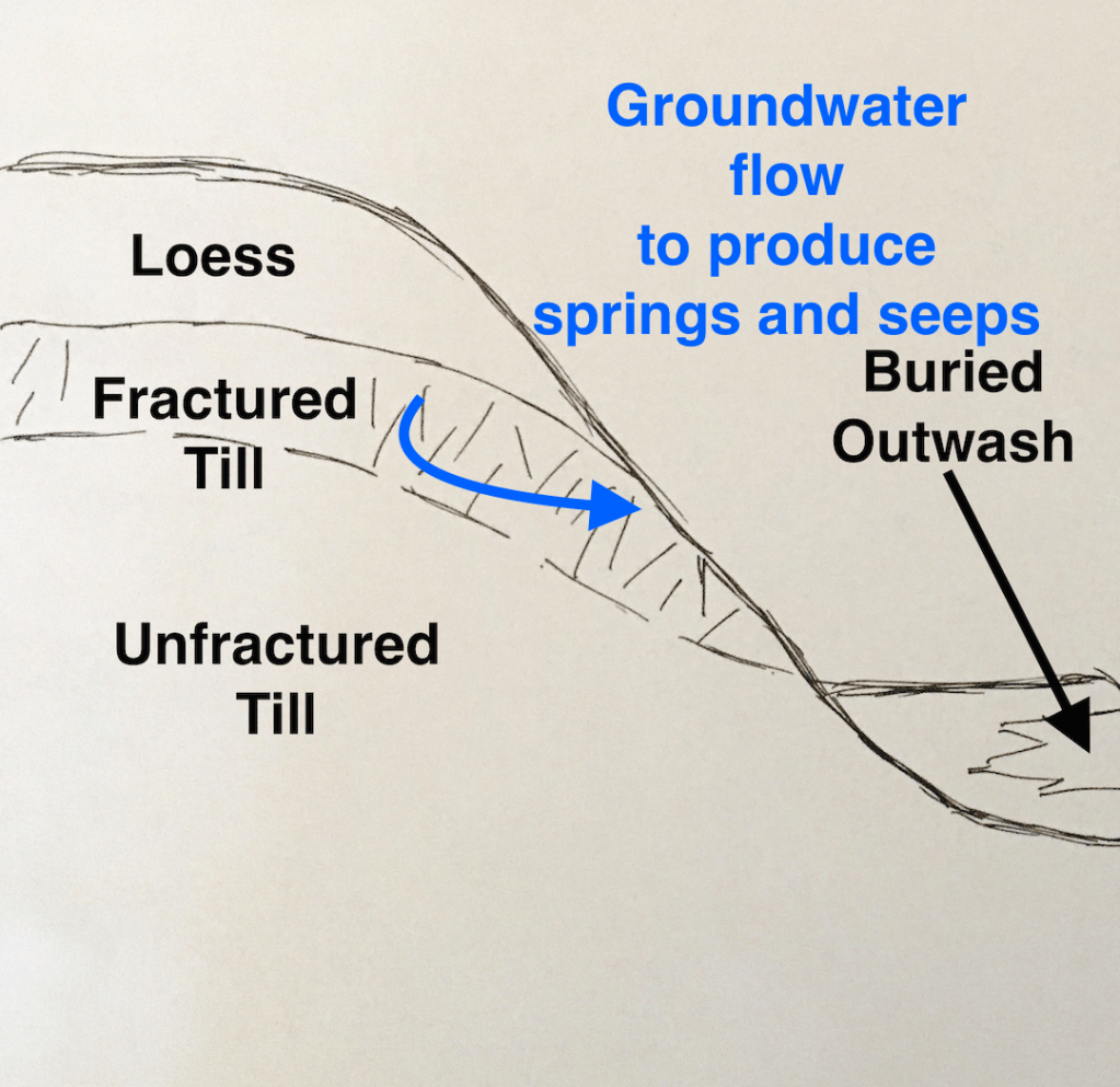
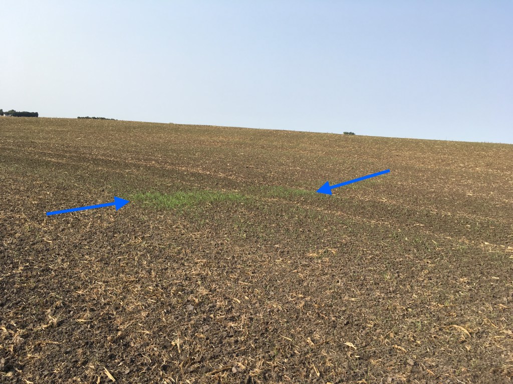
This cartoon is modified from last week’s post that introduced the ideas about underground water stored in aquifers on the Farm. The layer of fractured till is sandwiched between windblown silt and unfractured till in the hills and uplands that surround the Creek valley. Groundwater moves through fractured till and leaks out onto the surface as springs and seeps. The photo on the right is of a hill slope with newly planted cover crop. The first green whiskers of rye grass are growing in a linear pattern that probably reflects a particularly “leaky” fracture.

This fall photo shows a band of dark green vegetation that is probably getting help from groundwater that’s seeping out of the hill. It’s been a dry fall so the watered grass is particularly conspicuous. A similar band of differences in vegetation could be seen on this hillside earlier in the summer.
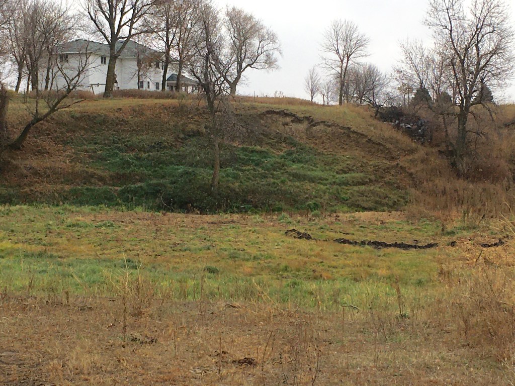
Similarly, the landslide behind our house is now marked by dark green vegetation that gets groundwater from the fractured clay till in the hill. The dry weather this fall gives brown grass for a contrast. Back in June there was actually standing water in the low spots between the landslide blocks. Now there’s less groundwater seeping out onto the surface.


The drought this fall has reduced the amount of water stored in the fractured till aquifers. Clay hill slopes like the photo on the left, that had active seeps last year now this fall are bare and dry as shown in the photo on the right. Actually, the springs were sill active this past summer, but now everything has dried up.
These near-surface aquifers like fractured clay till and like the terrace outwash described last week are easier to visualize and we can actually see the results of them leaking water out onto the land surface. In contrast, the outwash sand and gravel buried under the Creek’s floodplain are more subtle and open to interpretation. We’ll tackle that buried aquifer in next week’s post.
