
The Kanaranzi Creek has had sustained flows at high water levels over much of the past two years. As a result, very active erosion has exposed a whole variety of features.
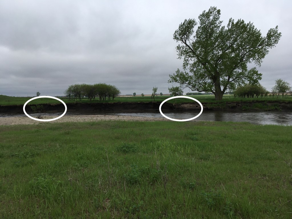
This is a view of the high channel bank near the bluff just north of our house. The oxbow described in the last two posts is located less than a quarter mile downstream behind the plum thicket and between the two white ovals. The first of four unique features are located within the ovals and are shown in the two photos below.
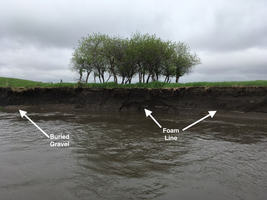
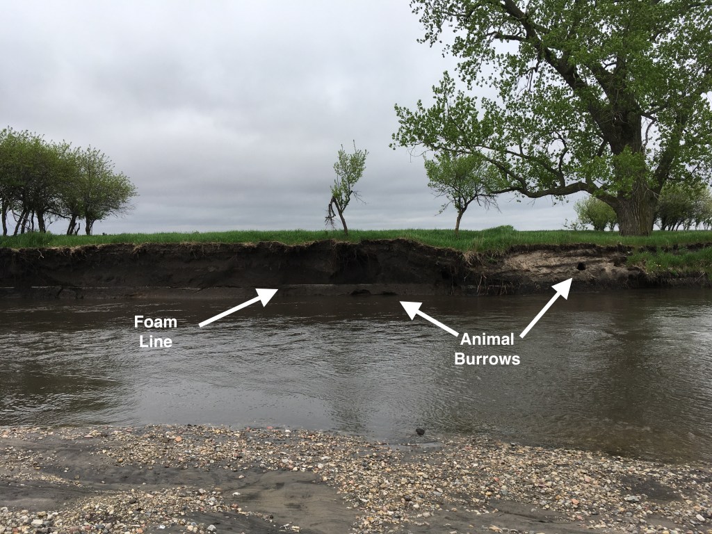
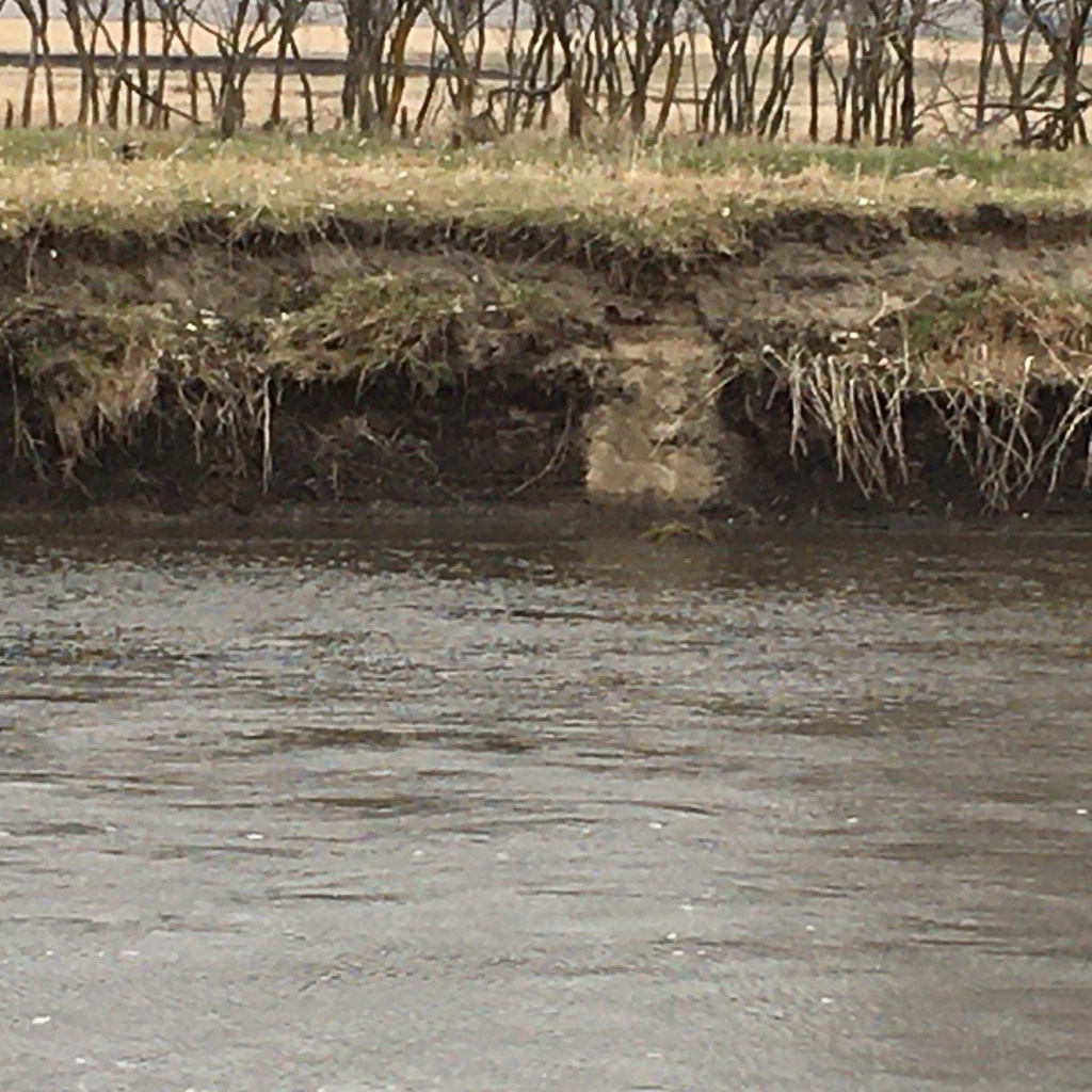
The foam line marks the high water level in mid-April after a two-inch rain event. The water has now dropped to a level approximately the same as before the rain so now we can see features above water that we haven’t seen for several years. The light-colored gravel exposed just above the water was deposited by melt water from the last glacier and we’ve found bones of Ice Age animals that have probably come from this layer. The gravel is buried beneath black silt deposited more recently by the Creek. The photo on the right shows modern animal burrows down at the water line (dark semicircles below the foam line) and also up higher in light colored sand. The lower burrows were probably beaver dens, but the burrows up in the sand may have been exposed by active bank erosion. That critter probably burrowed down from the grassy surface and now has his living room opened out into the creek bank. The view is better, but that home is now no doubt abandoned.
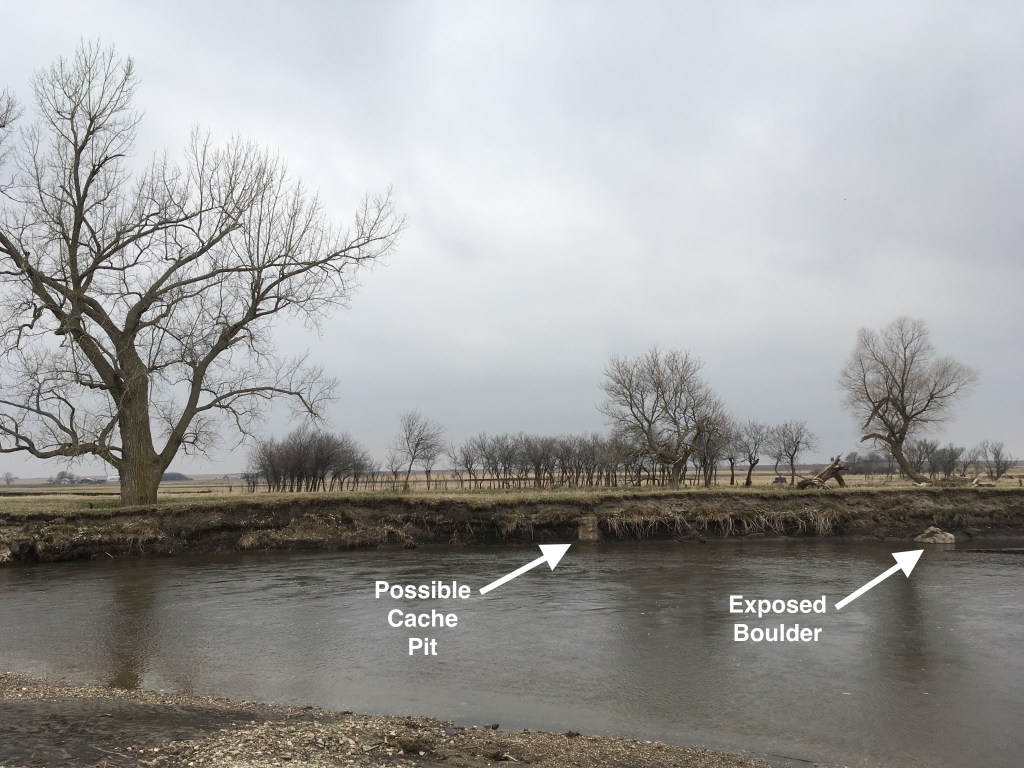
This is a view of the same high channel bank now looking to the right of the cottonwood tree. It was taken earlier this spring before everything was green and when the water level was still pretty high. There also had not yet been much of the spring-time erosion, so there’s a unique pattern preserved that may have archaeological significance. The vertical light colored band shown in the photo on the right seems to have a triangular “plug” of grass at the top. This geometry is similar to the pattern of a cache pit used for storage by Native Americans. In fact this is near an area where we’ve found artifacts and buffalo bones so that might support the interpretation of a storage pit. In any case, you can’t see it now because of recent bank modifications. In contrast, the exposed boulder can now be seen even more clearly because of the lower water levels.
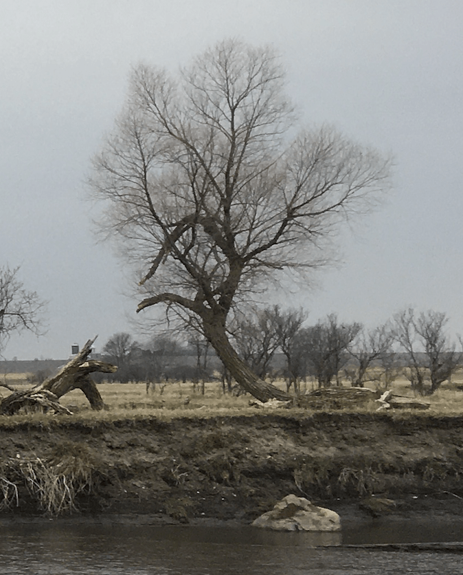
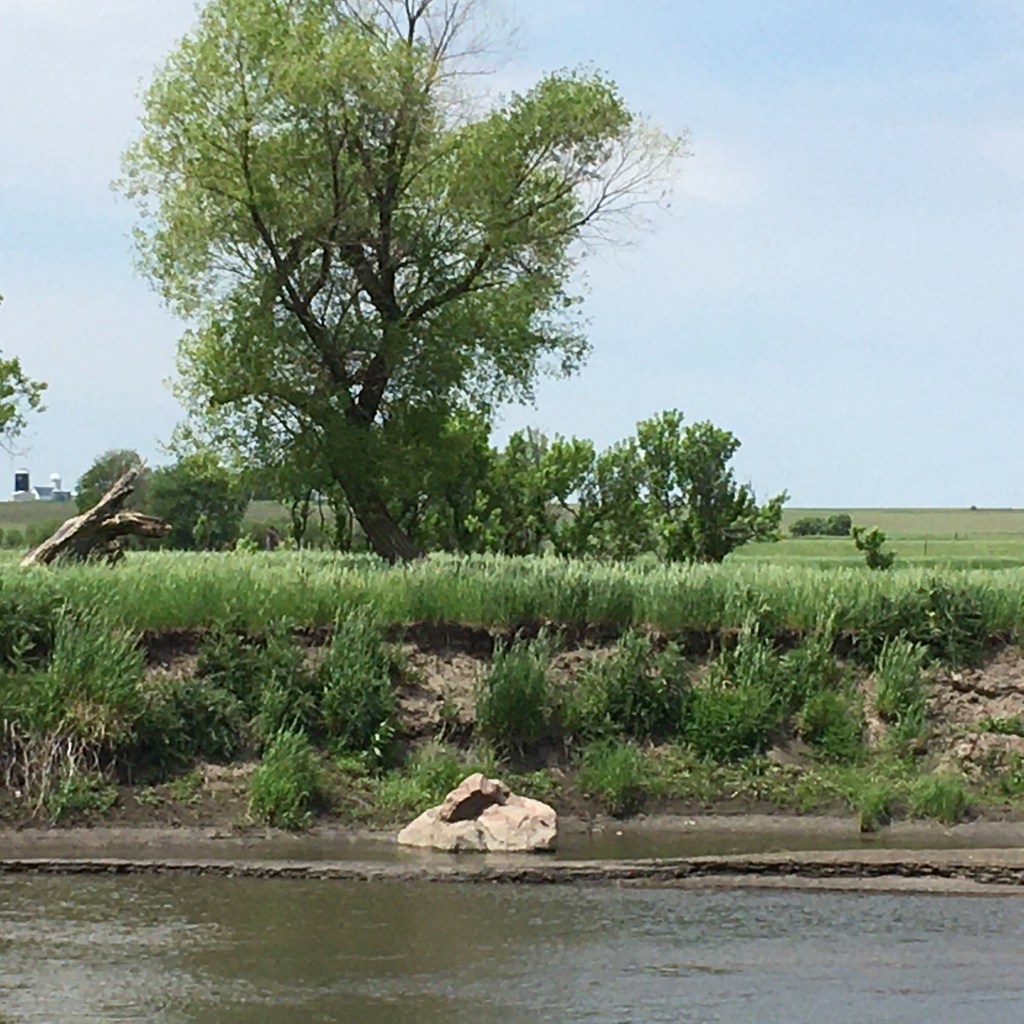
These two photos compare views of the boulder from earlier this spring to this past week. There’s less of the boulder exposed at the higher water level; at several times over the past two years the boulder was completely under water. Now, the boulder looks like it’s almost out of the water and surrounded by dark mud. Several years ago, before the high water flows, the boulder was not exposed at all because it was completely buried back in the bank behind it. The high bank has eroded back several feet to now expose that hidden boulder. As one of our neighbors commented, “Someday that boulder will be out in the middle of the channel.” He’s exactly right and he was concerned because he and his family and friends have canoed the Creek and the boulder is a new challenge and/or landmark.

Turtle will also use mammal bank burrows for overwintering
LikeLike
Thanks, Lisa. We do know that we have turtles!
LikeLike
Pingback: The Rock That Hides | Lone Tree Farm on Kanaranzi Creek