
Yesterday we got almost one and a quarter inches of rain. It won’t exactly break the drought, but it’ll really help the crops. The Creek has come up, but the dry pond and wetland in the oxbow will probably stay dry. And, the changes in the Creek will continue.
A couple of weeks ago a survey team from the Minnesota Department of Natural Resources (DNR) measured specific places on the Creek channel that have been monitored for almost a decade. In 2014 the main channel cut through a narrow bank and abandoned a meander loop that is called an oxbow. That short-term, dramatic change has been followed by more subtle long-term changes in the channel. And all of those changes have been documented by the measurements done by the DNR survey team.
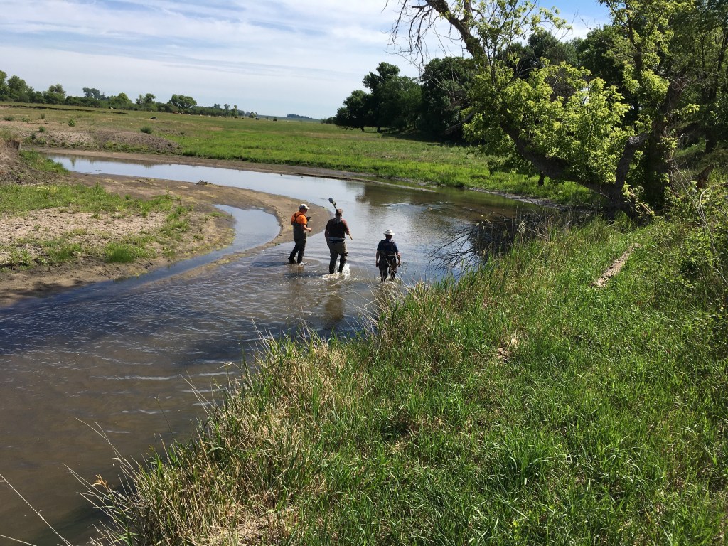
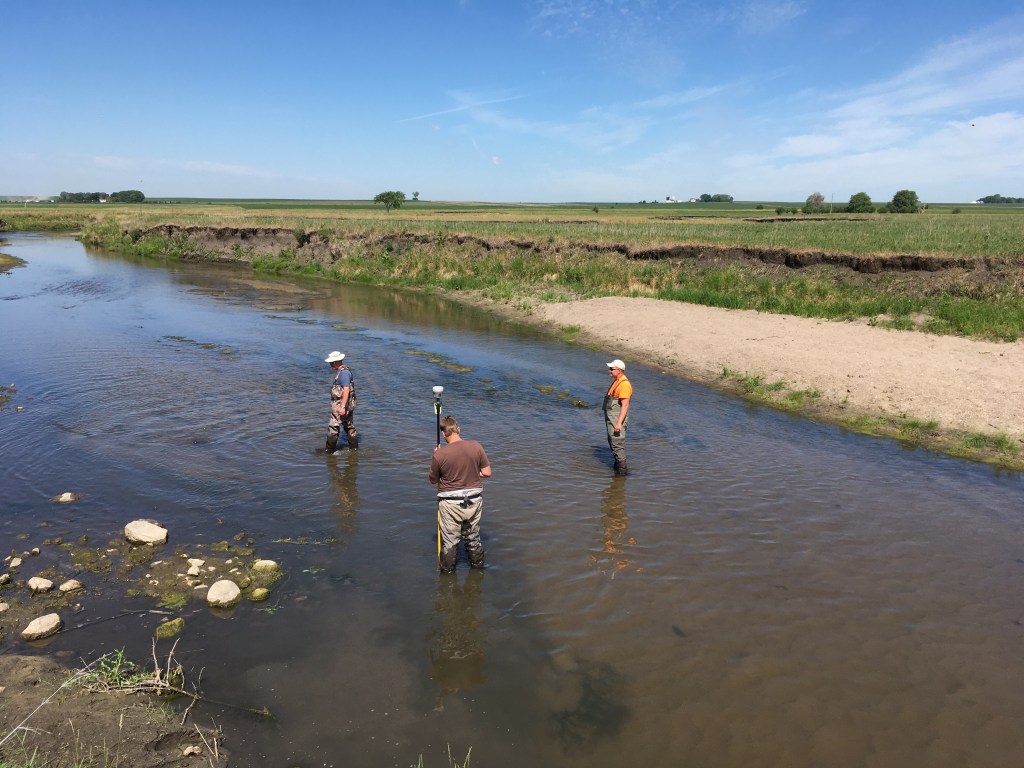
This year there were three people, but a fourth person has been here for many of the surveys. It’s not only the Creek channel that has changed. We all have aged and had life changes and the technology for surveying has changed. The global positioning system (GPS) that the team originally used had a remote, stand-alone base station to access the satellites and the survey rod communicated with that station. The new setup has the whole miniaturized system mounted on top of the rod so it’s much faster and easier to conduct the survey.
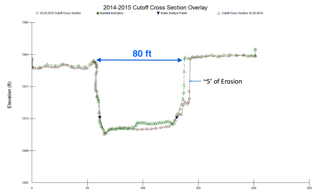

Here’s the results from four of the surveys; 2014 and 2015 were just after the channel cutoff happened and 2018 and 2021 are the most recent data. The early cross section (on the left) shows five feet of lateral change on the east side of the cut and essentially no change on the west. In contrast, the later cross section (on the right) shows ten feet of erosion on the west and very little change on the east. The total change in the gap goes from about 80 feet wide to almost 110 feet. These numerical changes are clearly shown on the cross sections constructed using the quantitative data from the surveys, but the visual comparisons are more dramatic.


The photo from the spring of 2014 shows the slump blocks that were left behind immediately after the channel cut through. The blue arrows point to the edges of the cut shown in the surveyed cross section. The photo from the summer of 2021 does show the steep edges of the cut at the black dirt on the left and right side of the channel. But, it also shows a sand bar deposited in the gap as the channel migrated to the left (west) while eroding the steep bank on that side. So, the changes in the channel include building up by sand deposition and also removing soil by erosion. Here’s the link to a post that shows the patterns of erosion and deposition from above in map view.
Long-term surveys like this are not common in government agencies because of changes in personal and priorities. I once spent two months on a team of five people measuring layers of sedimentary rock in central Montana, but the report was never written up because of political changes within the next year or two.
In the case of this DNR work, the same scientists did the multiple surveys but like the erosion and deposition there were changes in the lives of those people. Families have grown and gone. Young children are now in high school. One person, who had recently married back in 2014, now has kids and one of those kids has fishing videos posted on You Tube. Another person who was single several years ago is now engaged.
So the people who conducted the surveys and who study the changes in the Creek channel have experienced changes in their personal lives. Maybe we should also think about the Creek as a dynamic, living entity.
