
Six generations of kids have hunted for arrowheads and buffalo bones along Kanaranzi Creek. But, in the last two or three years it seems like the high water levels have opened up a treasury of cultural resources. An archaeological survey of Rock County and two adjacent counties done in the early 1980s demonstrated that most sites are located along streams. There are currently 94 formally documented sites in Rock County listed by number in the Office of the State Archaeologist. Of those, 11 are classified as “artifact scatters” that have both lithic and/or ceramic artifacts; these may be habitation sites. Two of those sites with artifact scatters are located on Lone Tree Farm.

This summer, prehistoric corn cobs were found at the western site (21RK0019) and a piece of pottery was found at the eastern site (21RK0082). These are small and light-weight items that have probably been carried by the Creek from eroding steep channel banks and deposited on nearby sand bars called point bars. This map shows areas of erosion (areas in red) and deposition (areas in yellow) between 2016 and 2018. It’s speculated that erosion of the upstream steep, eroded banks has exposed archaeological features such as cache pits. The artifacts that are washed away are subsequently deposited at specific locations on the downstream adjacent point bars.

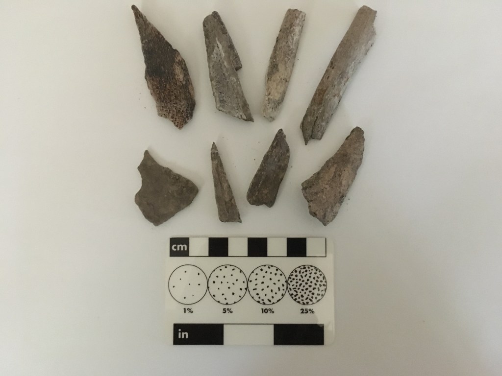
The light-weight piece of pottery and corn cobs were found near slow-moving, low water at the position where mud and sand have been deposited. The fragments of bone associated with the pottery and cobs are really small and don’t weigh much. Higher on the sand bar where fast-moving high water has deposited sand and coarse gravel, the pieces of bone are much larger and heavier. The photo on the left is of larger fragments from higher on the bar at the west site (21RK0019) where the corn cobs were found down close to the low water level. The photo on the right shows small bone fragments found with the piece of pottery on the lower part of the sand bar at the east site (21RK0082).
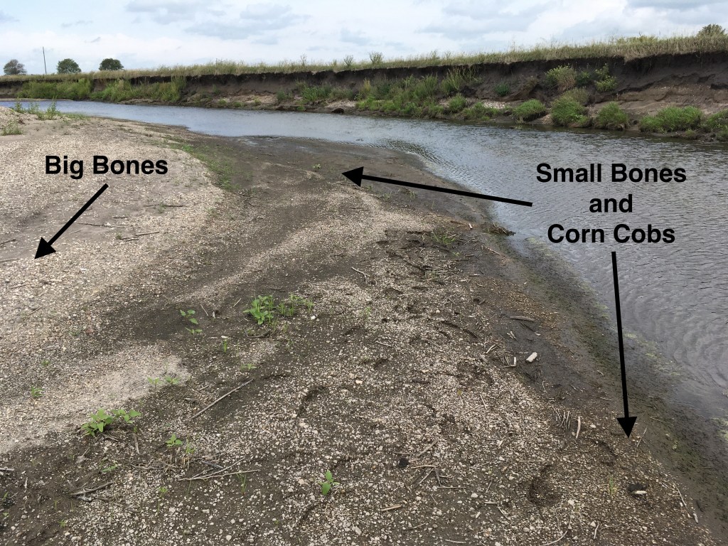

When the water is high, the current is strong and large pieces of bone or even big complete bones are dropped on the upper part of the sloping point bar. When the water level is low, the current is weaker so only small pieces are carried and deposited at a lower position on the sand bar. The left photo shows the locations big bones and little bones on the sand bar at the west archaeological site and the right photo shows the sand bar at the east site.


Record rainfall in 2018 and 2019 produced sustained high water flow conditions that ripped up a lot of the pasture. These fast-moving currents dropped some really big bones on the upper parts of the sand bars. Many medium-sized bone pieces were deposited at intermediate positions on the bars. These may have been shattered and cut during butchering; several buffalo skulls have been found at both sites. Some of the pieces almost look like tools, such as awls. However, it’s hard to really interpret their significance because they have been moved out of their original location in a buried archaeological feature. Context is super important and only systematic, professional excavation will lead to a realistic understanding of what happened here a thousand years ago.
There are, however, important implications for the archaeological sites along the Rock River and its tributaries in Rock County. Artifacts and bones may be deposited on sand bars just downstream from eroding steep channel banks that are cutting into buried archaeological features. This could be a serious threat to cultural resources that warrant “salvage” archaeological excavations.

That’s an interesting read.
LikeLike