
Prairie restoration programs often involve attempts to eradicate or at least limit smooth brome. This invasive, non-native, cool season grass is a vigorous sod-maker that usually expands to turn a pasture into essentially a monoculture. I understand why the restoration folks want to get rid of it, but it is also excellent for grazing. So in an attempt to diversify our brome and blue grass forage base, we’d like to find a way to locally control and replace brome.

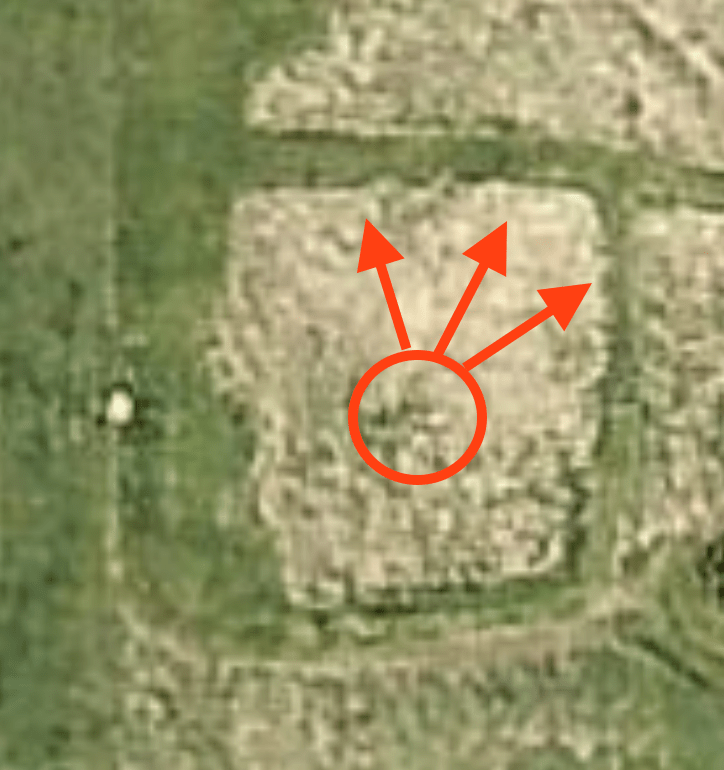
We’ve got about a dozen patches of native prairie marked by big bluestem as the main indicator plant. The August 5 post linked here describes four of them. Among the dozen prairie patches, two are warm-season plantings, but the others are from preserved indigenous seed banks. Most locations are in areas where the stand of brome is thin, like obvious west-facing hill slopes. But, other locations seem to be associated with subtle small-scale topographic features. In this post we’ll relate a cluster of three prairie patches (circled in blue) to slight topographic highs and propose an experiment on a planted prairie patch (circled in red).
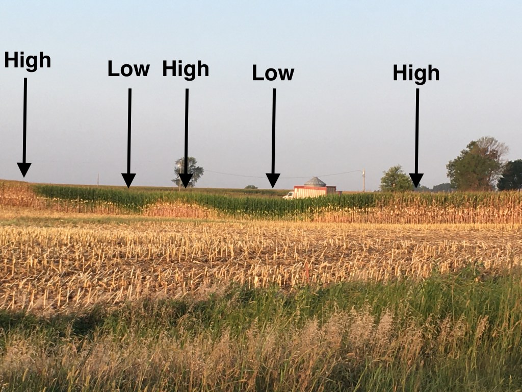
This past week a lot of the corn in our neighborhood was chopped for silage. This photo shows a “wall” of corn that illustrates the influence of subtle micro landforms in a floodplain setting. Green stalks mark wetter topographic low spots and brown ripe stalks spread over the subtle adjacent high spots. It’s a pattern that’s also seen in the brome and blue grass pasture.

This map has two-foot topographic contours that give a suggestion of subtle highs and lows that can be clearly seen when you’re actually walking the ground. More detailed elevation data would be helpful, but this information available from the county is adequate. There are limited stands of big bluestem mixed in with the brome on the subtle topographic high spots. However, the intervening low areas shown by brown blotches have no bluestem in the more dense brome development. This is essentially a top view of the pattern shown in a side view in the field of chopped corn.
The planted patch of big bluestem near our house has been established for about seven or eight years. However, in the last three or four years Margaret has maintained a mowed path around it. There’s been an on-going debate about this mowing. I hate to do any more mowing of tall grass (brome or bluestem) than is necessary, but she likes the trimmed look better. This year we noticed that the bluestem seemed to have expanded out toward the east and north mowed paths. Did the mowed brome at the margins of the patch allow the bluestem to expand through the root system or maybe the dominant wind from the south has dispersed bluestem seed to the north?
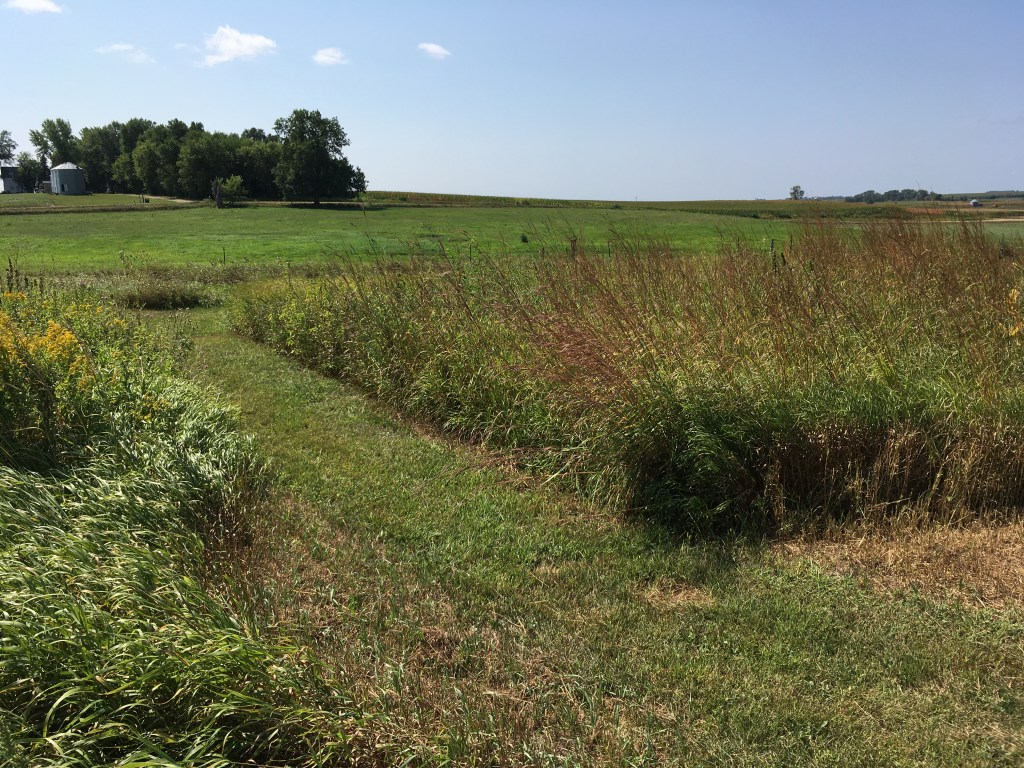
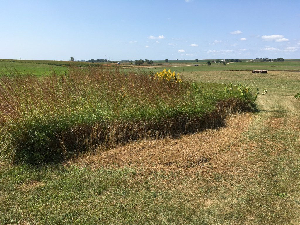
These two photos show the ground view of the two mowed paths. On the left, the bluestem with its distinctive red stalks, has reached the edges of the mowing on the east. On the right, the bluestem is also at the edge of a mowed area on the north. But, this is a newly mowed strip (marked by the brown grass) next to the long-maintained path (showing as the green area with brown grass clippings to the right). So, this is an experiment. Will the bluestem expand out into the mowed brome? Also, will Margaret be the ultimate winner of this long-standing debate about mowing the tall grass?
There are numerous anecdotes about native prairie plants expanding out of road ditches and fence lines. Maybe this unmanaged process can be replicated to coax expansion of established prairie patches on local subtle high spots out into the surrounding areas dominated by thick brome. Managed disturbances like grazing or burning (or mowing or spot spraying or even flooding) on the margins of the micro landforms may encourage the bluestem to grow out into the stressed brome. This might be an example of “precision conservation” because the topographic features that host the native plants are so small and subtle. In any case, this localized approach may provide an alternative to the wholesale conversion of brome-dominated paddocks.
