


The last two years we’ve had record rainfall and Kanaranzi Creek has changed a lot because of it. Although the spring melts have not produced much flooding, the summer “rain bombs” have resulted in bank-full flows sustained over long periods of time. Large blocks have slumped off the walls of the channel and wide new areas of fill have given the Creek a new look.
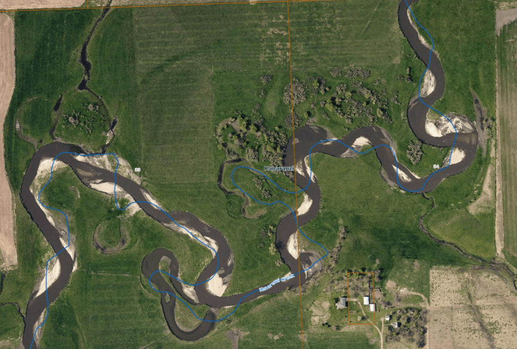
This photo shows the location of the channel in the spring of 2019. It’s a high resolution air photo available from the local county. Areas of fill are obvious because of the light-colored sand deposits, but the cut banks and eroded slump blocks are a little harder to see. The blue line is the channel position taken from mapping many years ago, so you can get some idea of how the Creek has shifted. This total photo is data. It has information that can be used to interpret exactly how much cut and fill has happened in the last three years.

The specific areas of cut and fill can be mapped and measured on air photos. This image was prepared by Arlyn Gerke who works in the Rock County Land management Office and is an expert in geographic information systems (GIS). It shows that between 2016 and 2019 more than 8 acres were lost to eroding cuts (shown in red) and almost 2 acres were gained by depositing fill (shown in yellow). These are interpretations based on the data. The eroding red areas could be stabilized and the yellow fill areas could be planted with a cover crop protection. However, both of those statements move beyond observation and interpretation and into the realm of opinion.
Opinion is a slippery slope. We could argue about the ultimate causes of the flooding, like climate change or agricultural drainage tiles, or we could argue about how to “fix” the channel with riprap protection or planting native grasses with deep roots. But, these are ideas based on interpretations and these ideas get progressively farther removed from the basic data. The people with the best ideas are the ones who understand the interpretations and who are closest to the data.
Still, opinions can lead to useful action. In the case of the Kanaranzi Creek, one possible action will be to plant a diverse mix of native plants in the areas of bare fill. Another possibility would be to establish native grasses along the steep banks, although the existing brome grass sod will make that difficult.
In the case of the currant Covid-19 crisis, we need actions based on opinions that are rooted in data-based interpretations. That’s the job of the National Institute of Allergy and Infectious Diseases (NIAID), the Center for Disease Control (CDC) and other governmental agencies. That’s what Dr. Anthony Fauci is trying to communicate to the nation. And, that’s what we need to understand as informed citizens.

My goal is to listen to opinions that are deeply rooted in data-based interpretations in these unprecedented times in which we are living. Thanks for the post! Good job!
LikeLike