
The high rainfall this year and last year has saturated the subsoil and filled the underground storage “tanks”. Actually these buried aquifers are NOT open spaces, like caves, flooded with water. But, instead they are layers of sand and gravel saturated with the water stored in tiny void spaces between the sand grains and gravel pebbles. And, when the buried aquifers spill out onto the land surface, we get springs. A lot of springs this year.
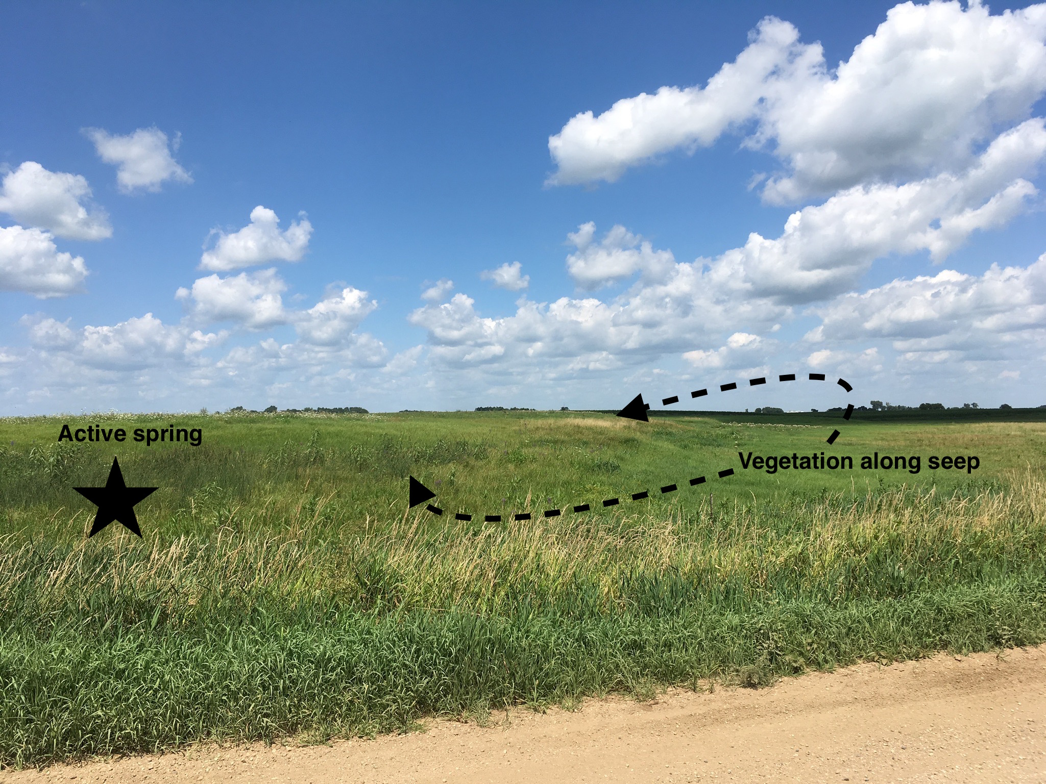
This is the fairly permanent spring that we have in the western part of the farm. The active spring is marked with a star in the dark green vegetation. And, the band of yellow and light green vegetation along the edge of the hill is where the layer of sand and gravel is leaking out to form a new spring this year.
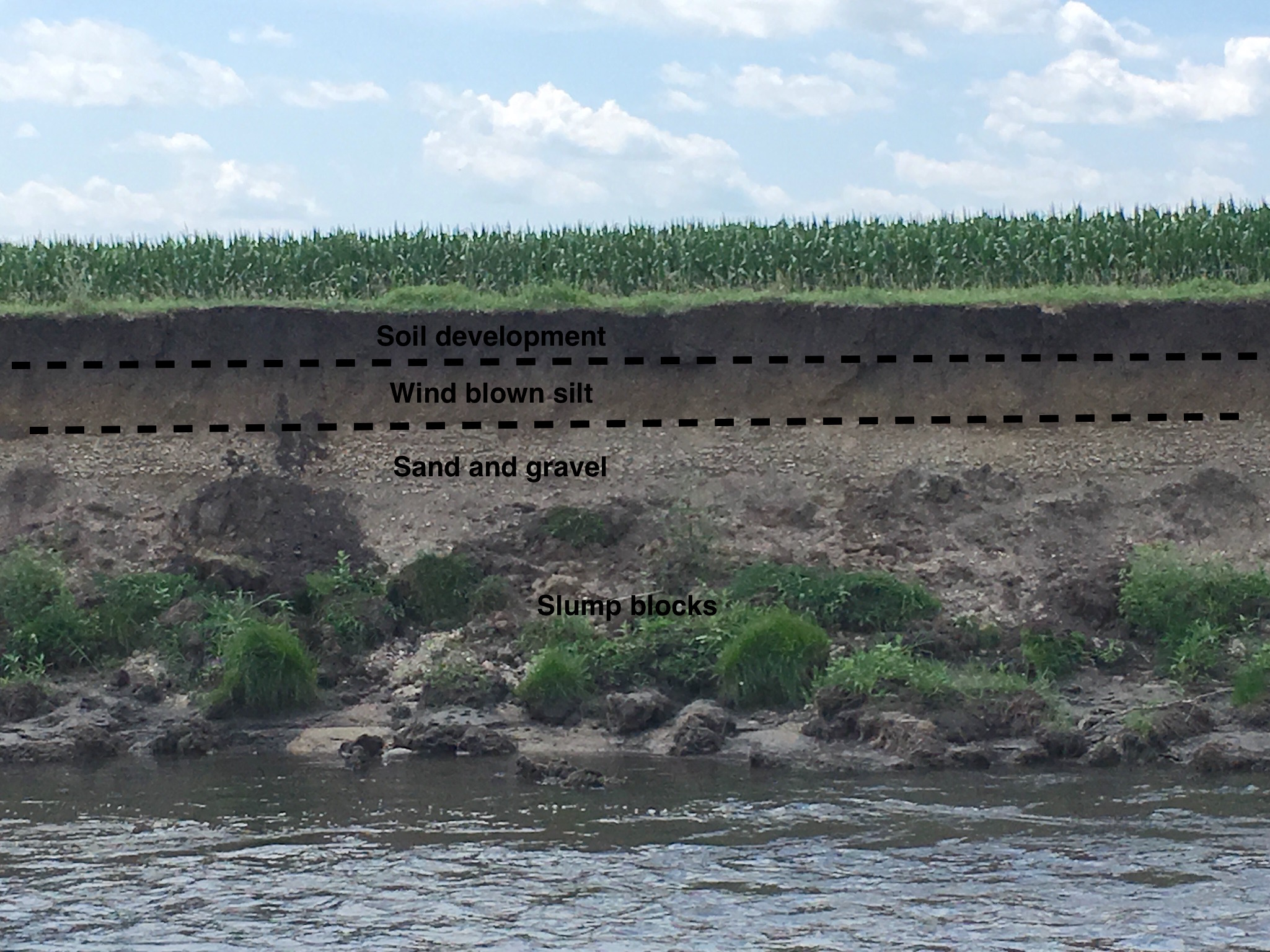
We can actually see the layer of saturated sand and gravel where it’s exposed in a high bank along the Creek farther north. Water from the uncovered aquifer goes directly into the Creek channel at this location. There’s a layer of wind-blown silt, called loess, covering the aquifer layer. Black soil has formed at the top of the silt. Loess is the parent material for all the good soil in this part of Minnesota, Iowa, and South Dakota.

There’s also a layer of sand and gravel buried down below the actual Creek channel. When this lower aquifer is filled up like this year, water flows directly into the channel water. However during a dry spell, the surface water in the Creek may flow back into the buried aquifer. The exposed layer of wet sand is basically unstable and big blocks of the over-lying clay alluvium (which was deposited when the Creek was flooding over it’s banks) slump down into the channel. The same thing has happened with the upper sand layer back over along the high bank.
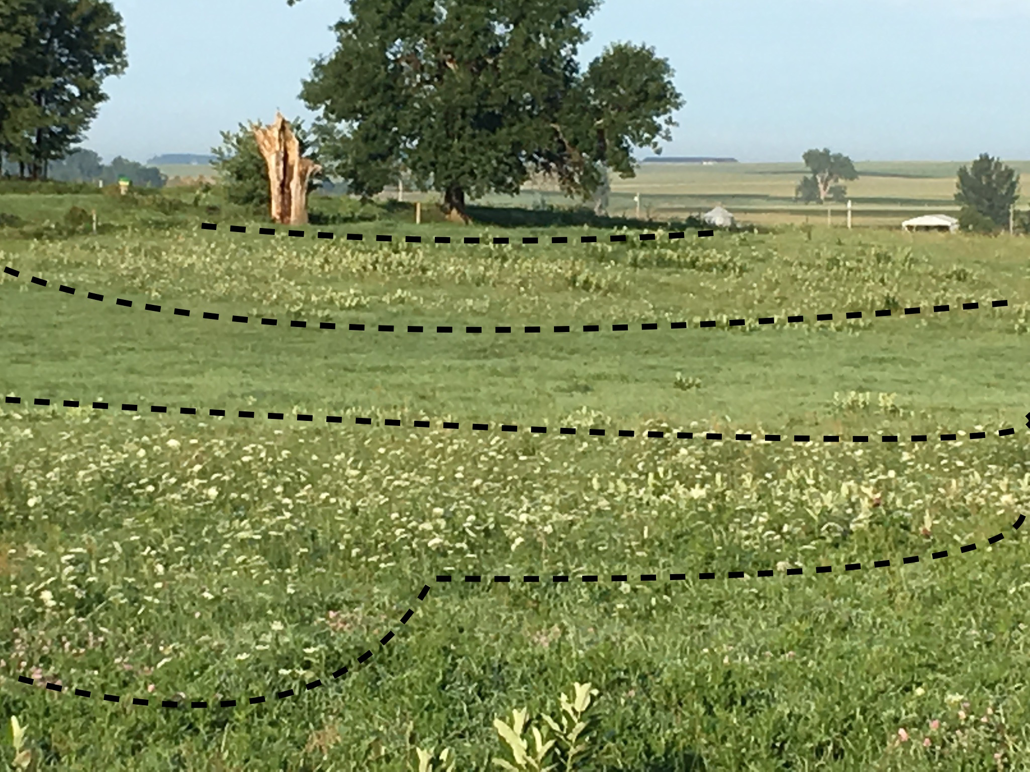
Upland hills are capped with loess rather alluvium and below the loess there’s clay that has interspaced boulders. This widespread geologic unit is called till and it was deposited directly by the ice in the old glaciers. Clay doesn’t usually store much groundwater, but if it is highly fractured it can act as an aquifer. The bands of Queen Anne’s Lace and white clover on this hillside probably mark moisture available from the fractured clay till. When the gravel road on a hill slope crosses the layer of saturated till, we get the frost boils and mud holes that have been so bad this year.
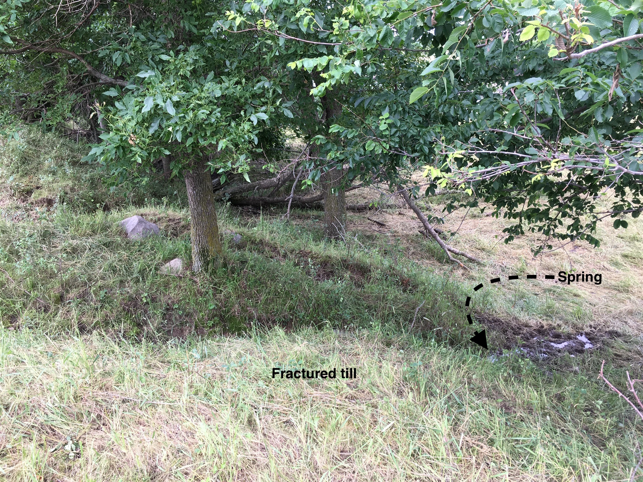
An active spring forms when the saturated, fractured till leaks its water out onto the side of a hill where it runs down to puddle up on the flat surface of the Creek’s floodplain. I’ve never seen a spring at this location, but this year there’s a new one. The boulders at the base of the tree are part of the till layer. This is the place where we got the boulder that became my brother’s headstone. Native American traditions link springs with places with spiritual significance and that certainly holds true for me at this spot.
